Geologic column was deposited by the Flood (Talk.Origins)
Claim CH550:
- The Flood deposited the geologic column.
Source: No source given.
CreationWiki response:
The wording of this claim is out of date. Creationists recognize that parts of the geologic record are pre- and post-Flood, with post-Flood naturally being the most recent. Furthermore, the fact the uniformitarian geologists claim that two layers were laid down at the same time, does not mean that a Flood geologist would draw the same conclusion.
For example:
| Location | 1 | 2 |
|---|---|---|
| Layer | A | C |
| Layer | B | D |
| Layer | C | E |
A uniformitarian geologist would conclude that layers C1 and C2 were formed at the same time, but a Flood geologist may conclude that A1 and C2 were formed at the same time.
(Talk.Origins quotes in blue)
1. Varves within the geologic column show seasonal layers over many, many years.
This is a purely uniformitarian assumption. Many layers of this type can form quickly in a liquefied material like concrete, so the varves in the geologic record may not be the seasonal layering.
* In many cases, such as the Green River formation, these layers are too fine to have settled out in less than several weeks per layer.
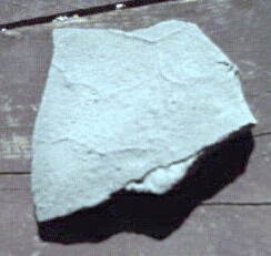
This slab is from the Green River formation.
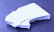
The layers in this chip of concrete are about as fine as those seen in above Green River slab. The concrete is from a spill and the dozen or so layers all formed in a day.
* Varves in New England show evidence of climate change 17,500 to 13,500 years ago which matches climate patterns in other parts of the world [Rittenour et al. 2000]. These layers prove that the geological record was not produced in just one event.
The dates assume the uniformitarian notion of these being annual layers. These varves are likely to be post-flood but the recovery from the Flood would have caused rapid deposition
2. There are many different kinds of surface features preserved in the middle of the geological column. These features include soils, mud cracks, evaporite deposits, footprints, raindrop impressions, meteor craters, worm burrows, wind-blown sediments, stream channels, and many others.
Most of these are uniformitarian interpretations, that have totally different interpretations under Flood geology.
- Soils.
There are at least three ways fossil "soil" can be explained in Flood Geology
|
Reference: Oard, Michael J et al, Are Paleosols Really Ancient Soils? Creation Research Society Quarterly 12-2003, pg 140.
- Mud cracks.
These lines on the underside of a chip of concrete were from expansion cracks . The layer below it had cracked without ever being on the surface. These formed below the surface and they closely resemble so called fossil mud cracks. This suggests that these so called fossil mud cracks also formed below the surface.
- evaporite deposits.
Such deposits can form quickly by the precipitation of a supersaturated salt solution. Such conditions could have occurred in relatively small areas during the Flood.
- Footprints.
Here are five possible explanations for fossil animal tracks. It needs to be noted that none of these are mutually exclusive and none explain all fossil tracks, but together they seem to do a good job of explaining them all.
|
Reference: In the footsteps of giants
- Raindrop impressions.
The bumps in this chip of concrete are identical to so called fossil rain drops, but these were formed in a concrete spill. They are the result of air bubbles not rain drops. The same could be true of so-called fossil rain drops.
Referenced site: Trace Fossils and Sedimentary Structuretrace Fossils and Sedimentary Structure
- Meteor craters.
Meteor craters are not a problem for Flood geology. Not all of the layers were covered up instantly, some would have been exposed to the possibility of an impact even if briefly. If the impact rate during the Flood was higher than the present rate, this could be sufficient to explain all impact craters.
- Worm burrows.
It turns out that fossil burrows are not dwellings but attempted escape routs of buried organisms. If a burrowing organism is suddenly buried it won't just sit there and think " Well it's time to die." It will try to dig its way out. Fossil burrows are consistent with this.
Reference: CRSQ Notes - Surface and Subsurface Errors in Anti-Creationist Geology
- Wind-blown sediments.
There are deposits such a sand waves that are interpreted as wind-blown sediment but that can also be produced by moving water. Some are actual wind-blown post-Flood sediments.
- Stream channels.
During the Flood under-water currents could have carved out channels in soft sediment. After the Flood, there would have been numerous lakes and waterways that are now dry.
* The Loess Plateau in China has a layer of loess more than 300 m thick. Loess is wind-blown sediment which would not occur during a global flood. The Loess Plateau occurs around the downwind edges of the Ordos Desert, its source of sediments, and the grain size of the loess decreases the further one gets from the desert. [Vandenberghe et al. 1997]
The seems to be two possibilities.
- At least some of the "loess" was actually deposited by moving water during the Flood.
- This plateau is a post-Flood deposit resulting largely from massive post-Flood sand storms
|
Such long estimates of soil formation time are based on uniformitarian assumptions, but yet their observed rates that suggest that these deposits could have formed in a hundred years or so, if not less.
Reference: Oard, Michael J et all, Are Paleosols Really Ancient Soils? Creation Research Society Quarterly 12-2003, pg 139.
For another discussion of some of these objections, please read Oard's Flood Follies (EvoWiki)
| |||||||||||||||||


