De CriaçãoWiki, a enciclopédia da ciência da criação.
Saltar para a navegaçãoSaltar para a pesquisa
Summary
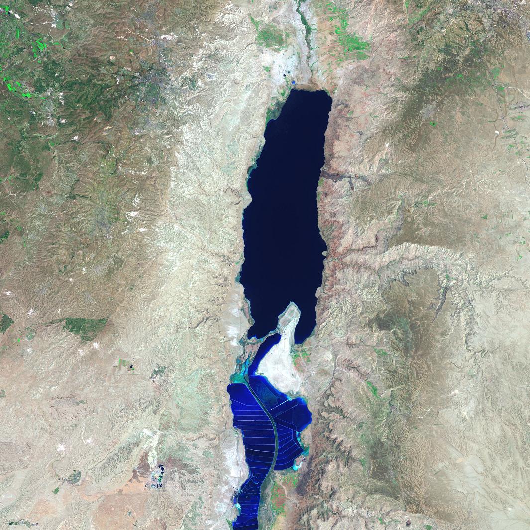
Dead Sea Satellite photo
In the Jordan rift valley, the continents of Africa and Asia are pulling apart from each other, and the land in between has been subsiding for millennia. The sinking has created the Dead Sea: rivers (most notably the Jordan River) drain into the deep basin created by the parting tectonic plates. The lake surface is nearly 400 meters (1,300 feet) below sea level, making it the lowest surface feature on Earth. The only outlet for the water is evaporation.
This Landsat 7 satellite image shows the entire extent of the modern Dead Sea on August 7, 1999. Deep waters are dark blue, while pale blue shows salt ponds and wetlands to the south. The pale pink and sand-colored regions are desert lands, while pale green shows vegetation. The mottled mixed of green and purple-gray are urban sites. Long, linear features running across the landscape are major roads. The false-color image was captured by Landsat’s Enhanced Thematic Mapper Plus (ETM+) sensor, using light from infrared, near-infrared, and green wavelengths (ETM+ bands 5, 4, & 2 respectively).
On a hot dry summer day, the 1,035-square-kilometer (405-square-mile) surface of the Dead Sea can drop as much as two to three centimeters (one inch) from evaporation, making the remaining water increasingly salty. In the past, the Dead Sea has been deep at the northern end and shallow at the south. Diversion of the water flowing in to the sea for agriculture in modern times has caused the Sea to separate into two separate lobes. The southern part is mostly dry except for ponds that are used to extract potash (a potassium-based salt) and other salts.
In such a parched landscape, fresh water resources are vital to national interests and security. Water diverted from the Jordan River provides agricultural needs for Israel, and water from various streams in Jordan provide for many of that nation’s needs. As a result of these diversions, the Dead Sea has retreated dramatically in the past decades, and will eventually dry up unless a new inflow of water is found. Feasibility studies are underway for projects that would build canals to carry in water from the Mediterranean and Red Seas.
Copyright status:
This image is public domain because it was first published by the U.S. National Aeronautic and Space Administration
Source:
http://visibleearth.nasa.gov/view_rec.php?id=17406
Histórico do ficheiro
Clique uma data e hora para ver o ficheiro tal como ele se encontrava nessa altura.
| Data e hora | Miniatura | Dimensões | Utilizador | Comentário |
|---|
| atual | 00h56min de 8 de abril de 2009 |  | 1 065 × 1 065 (302 kB) | Ashcraft | Dead Sea Satellite photo In the Jordan rift valley, the continents of Africa and Asia are pulling apart from each other, and the land in between has been subsiding for millennia. The sinking has created the Dead Sea: rivers (most notably the Jordan River |
Utilização local do ficheiro
A seguinte página usa este ficheiro:
Este ficheiro contém informação adicional, provavelmente acrescentada pela câmara digital ou pelo digitalizador usados para criá-lo.
Caso o ficheiro tenha sido modificado a partir do seu estado original, alguns detalhes poderão não refletir completamente as mudanças efetuadas.