File:Plate tectonics map.jpg
From CreationWiki, the encyclopedia of creation science
Jump to navigationJump to search
Size of this preview: 800 × 436 pixels. Other resolution: 1,217 × 663 pixels.
Original file (1,217 × 663 pixels, file size: 298 KB, MIME type: image/jpeg)
|
This image was uploaded to the shared "Image Pool" and is usable on any CreationWiki site. |

Summary
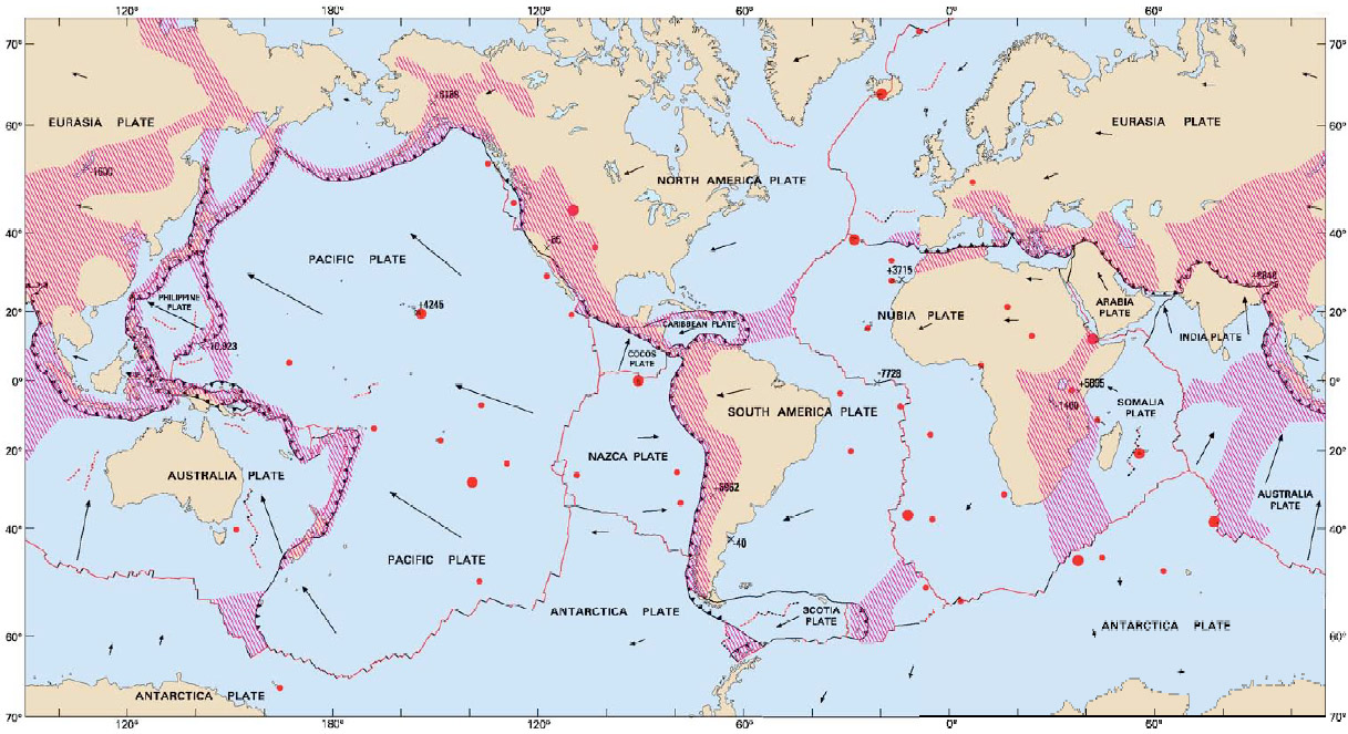
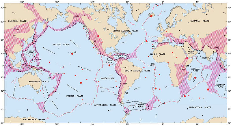
Interpretive map of plate tectonics.
World Map of Volcanoes, Earthquakes, Impact Craters, and Plate Tectonics Third Edition (Published 2006). U.S. Geological Survey.
Copyright status
This image is public domain because it was first published by the U.S. Geological Survey
Source
File history
Click on a date/time to view the file as it appeared at that time.
| Date/Time | Thumbnail | Dimensions | User | Comment | |
|---|---|---|---|---|---|
| current | 23:04, 30 November 2008 | | 1,217 × 663 (298 KB) | Ashcraft | Interpretive map of plate tectonics. World Map of Volcanoes, Earthquakes, Impact Craters, and Plate Tectonics Third Edition (Published 2006). U.S. Geological Survey. |
File usage
The following 3 pages use this file: