File:Earthquake zones.gif
From CreationWiki, the encyclopedia of creation science
Jump to navigationJump to search
No higher resolution available.
Earthquake_zones.gif (640 × 538 pixels, file size: 175 KB, MIME type: image/gif)
Source USGS (public domain) http://pubs.usgs.gov/publications/text/zones.html
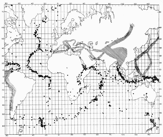
As early as the 1920s, scientists noted that earthquakes are concentrated in very specific narrow zones (see text). In 1954, French seismologist J.P. Rothé published this map showing the concentration of earthquakes along the zones indicated by dots and cross-hatched areas. (Original illustration reproduced with permission of the Royal Society of London.)
File history
Click on a date/time to view the file as it appeared at that time.
| Date/Time | Thumbnail | Dimensions | User | Comment | |
|---|---|---|---|---|---|
| current | 01:12, 25 November 2005 | | 640 × 538 (175 KB) | Ashcraft (talk | contribs) |
You cannot overwrite this file.
File usage
The following page uses this file: