File:Bitis-arietans-range-map.png
From CreationWiki, the encyclopedia of creation science
Jump to navigationJump to search
No higher resolution available.
Bitis-arietans-range-map.png (358 × 390 pixels, file size: 13 KB, MIME type: image/png)
|
This image was uploaded to the shared "Image Pool" and is usable on any CreationWiki site. |
File history
Click on a date/time to view the file as it appeared at that time.
| Date/Time | Thumbnail | Dimensions | User | Comment | |
|---|---|---|---|---|---|
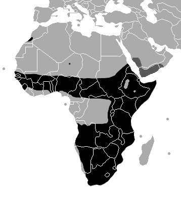
| current | 15:11, 4 January 2008 | | 358 × 390 (13 KB) | Lwashio | Geographic range of Bitis arietans. The distribution (black area) on the African continent is based on the map provided by Spawls & Branch (1995). The black dot in Niger reflects an actual locality record in an area where the distribution is poorly unders |
File usage
The following page uses this file: